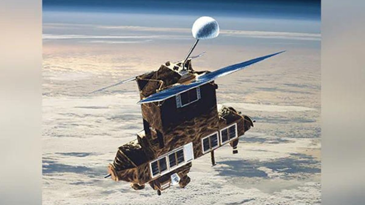
 "Nasa bids farewell to the historic Pathfinder Earth observation satellite after 16 years")
The Pathfinder mission was launched on 21 November 2000, and is an Earth observation satellite that was meant as a validation mission for a number of cutting edge technologies. The Pathfinder mission was part of the New Millennium Program that tested technologies and concepts never flown before, and that too at cheaper price tags.
After sixteen years in orbit, Nasa will turn the satellite off on 30 March 2017. The satellite has run out of energy, and will become inert. The satellite will continue to orbit the Earth till 2056, after which it is expected to burn up in the atmosphere of the Earth, streaking across the sky as it disintegrates.
Pathfinder was the first satellite to map lava flows from space, the first to measure the methane leak of a facility, and the first to track the re-growth in the Amazon forest after it had been partially logged. At launch, there were thirteen new technologies on board the Pathfinder, including three new instruments. One of the most important instruments was the Advanced Land Imager that tracked forest cover, crops, coastal waters and aerosols.
The Pathfinder satellite could be turned to the same spot on the Earth every two to five days, which was instrumental in disaster relief operations. Nasa made sure that images of events and natural disasters were available to whoever needed it. The Pathfinder satellite was used to track the spread of ash after the World Trade Center attacks, floods in New Orleans following Hurricane Katrina, a massive leak of Methane in southern California and several volcanic eruptions, including eruptions of underwater volcanoes. Over 1,500 research papers have been published because of Pathfinder images.
 "NASA wary of space collision between US spacecraft, Russian satellite")
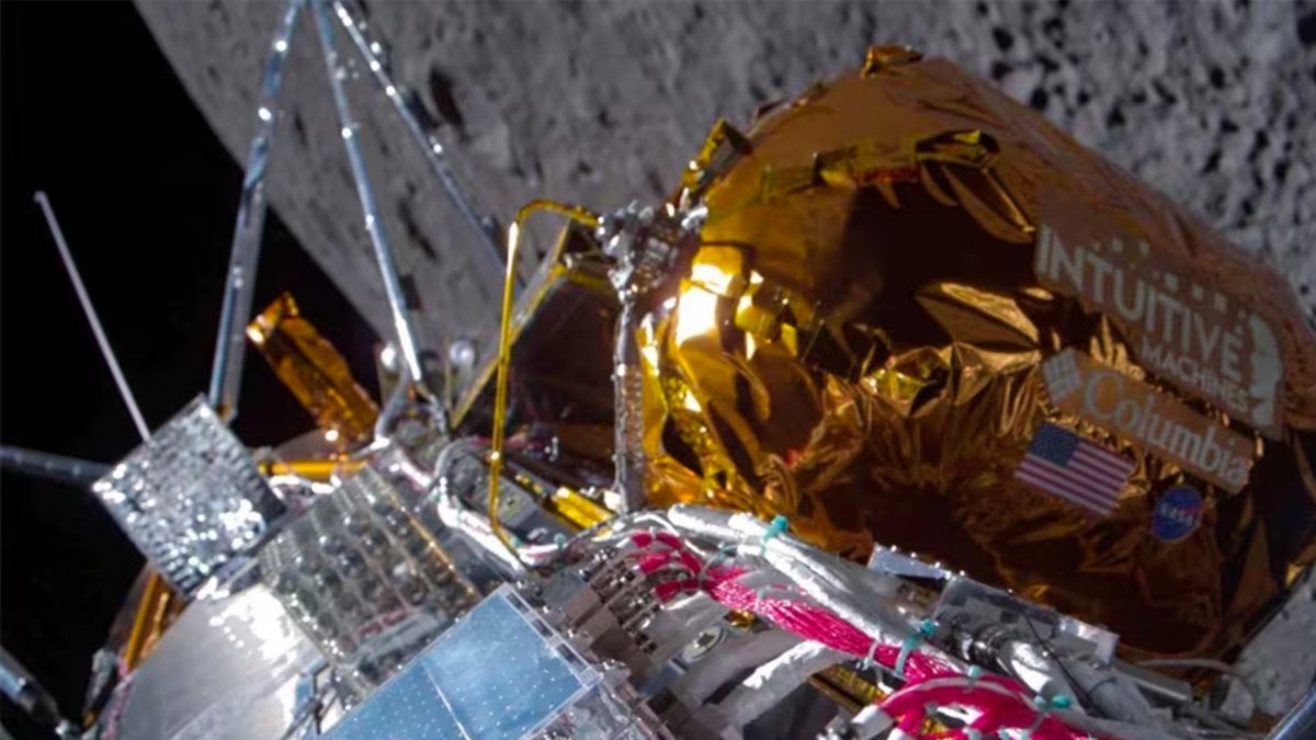 "WATCH: Intuitive Machines' Odysseus lands on the moon, first successful American lander in 50 years")
 "How Japan’s first-ever wooden satellite will be a game-changer")
 "Want to be ‘The Martian’? Dial NASA")