
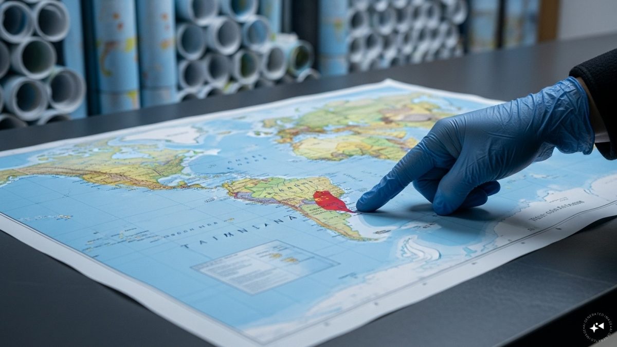
 "China seizes 60,000 maps mislabelling Taiwan, omitting South China Sea islands")
Chinese customs officials in Shandong province have confiscated 60,000 maps intended for export, citing errors in the depiction of Taiwan and key islands in the South China Sea. According to authorities, the maps were “problematic” because they allegedly “endanger national unity, sovereignty and territorial integrity,” a move that underscores Beijing’s heightened sensitivity over territorial representation.
The seized maps reportedly misrepresented Taiwan, which China claims as a province, and omitted the nine-dash line, Beijing’s extensive claim over the South China Sea that stretches hundreds of miles from Hainan province.
The maps also failed to show the maritime boundary between China and Japan. Officials did not specify exactly how Taiwan was mislabelled. Reuters reported that China views any deviation in maps as a challenge to its territorial claims, particularly amid ongoing regional tensions.
The South China Sea has long been a flashpoint in Southeast Asia. Beijing’s overlapping claims conflict with those of the Philippines, Vietnam, and other nations. Over the past weekend, Philippine authorities accused a Chinese vessel of ramming and using a water cannon against a government ship, a claim Beijing denied, saying the Philippine vessel “dangerously approached” despite repeated warnings, according to BBC.
Incidents such as these heighten the political sensitivity of maps, which are increasingly seen as tools of soft power and territorial assertion.
Maps are not neutral in the region. Vietnam and the Philippines have previously reacted strongly to depictions of the South China Sea, reflecting a broader regional sensitivity to cartographic representations.
Impact Shorts
More ShortsIn 2023, for instance, Vietnam banned the Barbie movie for including the nine-dash line, while the Philippines censored content containing disputed maritime boundaries, Al Jazeera reported. Such measures illustrate the symbolic weight maps carry in geopolitical disputes.
China Customs did not indicate where the confiscated maps were destined for sale, but the sheer volume 60,000 copies is significantly higher than in previous cases. In March, 143 nautical charts were seized at Qingdao airport for containing “obvious errors” in national borders, while Hebei province authorities confiscated two maps in August for “misdrawn” Tibetan borders.
Analysts say that large-scale confiscations send a clear signal to both domestic and international audiences about Beijing’s strict stance on territorial representation.
“The focus on maps demonstrates the symbolic importance China places on its territorial claims,” said a regional analyst told CNN. “It’s not just about controlling physical territory, but also the narrative that surrounds it, including what is considered internationally acceptable representation.”
The timing of the seizures comes amid increased scrutiny of Chinese maritime activity. Territorial disputes, particularly in the South China Sea, continue to provoke diplomatic friction, and misrepresentations even on exported maps can trigger political backlash. By confiscating the maps, Beijing reinforces its zero-tolerance policy for perceived challenges to sovereignty while also asserting control over narratives exported abroad.
Experts say such incidents may exacerbate regional tensions. “Even minor errors in maps can be interpreted as challenges to sovereignty,” a scholar at the National Chengchi University in Taipei told Al Jazeera. “These confiscations are as much about controlling information as they are about national security.”
While Taiwan maintains its own constitution and democratically elected government, China’s strict approach reflects a broader strategy to assert territorial claims across multiple fronts, including maritime boundaries, educational content, and cartography.
Observers say that the confiscation of 60,000 maps is a reminder of how sensitive these issues remain in the Indo-Pacific, where small symbolic gestures can have outsized political ramifications.

 "US ready to ‘impose costs’ on Russia if war in Ukraine drags on, says Hegseth")
 "Pakistan-Afghanistan announce 48-hr ceasefire: Who could bring conflict to a permanent end?")
 "'Arrangements at New Delhi World Para-Athletics Championships much better than Kobe and Paris': India's Ekta Bhyan")
 "India's Ahmedabad set to host 2030 Commonwealth Games, final decision in November")


