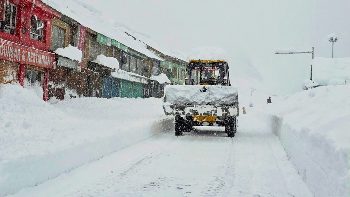
 "A vehicle moves on a snow covered road amid snowfall, at Sonamarg in Ganderbal district of Jammu and Kashmir, on 19 February, 2024. PTI")
Spring has arrived quickly in India as temperatures started to soar last week. The sudden exit of winter is surprising for many, but it has also induced a phase of wet weather for India, which has begun impacting northern India in the first two days of the current week.
A fresh western disturbance has started to affect the Himalayas, bringing moderate snowfall over Kashmir, Ladakh and Himachal Pradesh during 18-20 February, 2024:
Snow accumulation was reported in parts of Lahaul on 18 and 19 February:
Kukumsheri: 45cm
Triloknath: 45cm
Hinsa: 45cm
Thirot: 45cm
Udaipur: 40cm
Tindi: 20cm
Jasrath: 20cm
Pattan Valley: 30cm
Jispa: 13cm
Sissu: 10cm
The weather became abnormally warm in the Himalayas. Gulmarg in Kashmir recorded a maximum temperature of 10.8°C on 16 February, which was 10°C above normal and not far from its February record:
11.4°C on 11 February, 1993
10.8°C on 29 February, 2016
10.8°C on 16 February, 2024
The current spell of precipitation has helped reduce the temperatures once again, and Gulmarg reported a maximum temperature of 0.3°C on 18 February.
Rainfall recorded in the span of 48 hours ending at 8:30 AM on 20 February, 2024:
Kashmir region
Srinagar: 41.4 mm
Qazigund: 89.6 mm
Pahalgam: 58.7 mm
Kupwara: 84.6 mm
Kokernag: 34.0 mm
Gulmarg: 101.0 mm
Pampore: 28.0 mm
Srinagar Airport: 44.4 mm
Awantipora: 22.8 mm
Anantnag: 32.0 mm
Larnoo: 16.0 mm
Pulwama: 19.0 mm
Impact Shorts
More ShortsGanderbal: 52.0 mm
Budgam: 36.0 mm
Baramulla: 88.0 mm
Bandipora: 86.0 mm
Khudwani: 15.5 mm
Jammu region:
Jammu: 10.7 mm
Banihal: 143.4 mm
Batote: 85.2 mm
Katra: 29.6 mm
Bhaderwah: 85.5 mm
Kathua: 20.4 mm
Jammu Airport: 11.0 mm
Udhampur: 38.8 mm
Ramban: 132.5 mm
Poonch: 55.0 mm
Rajouri: 51.5 mm
Reasi: 25.0 mm
Samba: 5.0 mm
Chatha: 5.5 mm
Meanwhile, while it’s just spring in the plains of North India, summer has arrived in South India, especially in Kerala, where minimum temperatures have started to exceed 25°C at most stations, with maximum temperatures recorded in the range of 34 to 38°C.
Maximum temperatures reported in various cities of Kerala on 19 February:
Trivandrum: 34.7°C
Punalur: 36.4°C
Alappuzha: 36.0°C
Kottayam: 37.0°C
Kochi: 36.4°C
Palakkad: 35.7°C
Kannur: 36.6°C
Most parts of Central, West, and East India are experiencing dry weather conditions and are on the cusp of transitioning from spring to summer, with maximum temperatures reported in the range of 30-35°C. Nationwide temperatures have remained 2-4°C above normal in the past few days.
The pan-India actual rainfall so far from January 1st to February 20th stands at 21.1mm, compared to the normal of 33.0mm. The departure from normal currently stands at -36%, reduced by 3% week over week.
Subdivision-wise winter seasonal rainfall till 20 February, 2024:
Southern Peninsula: Actual 18.6mm against the average of 13.6mm, +37% departure from normal.
East & Northeast India: Actual 21.8mm against the average of 37.0mm, -41% departure from normal.
Northwest India: Actual 37.0mm against the average of 65.0mm, -43% departure from normal.
Central India: Actual 7.8mm against the average of 13.0mm, -40% departure.
Current synoptic weather features influencing weather in India as of 20 February, 2024:
• The Western Disturbance, initially a cyclonic circulation over north Pakistan, now lies over central Pakistan and adjoining Punjab at 3.1 km above mean sea level, with the trough aloft in middle tropospheric westerlies. Its axis is at 5.8 km above mean sea level, roughly along Long. 70°E to the north of Lat. 30°N.
• The induced cyclonic circulation over central Pakistan now lies over Punjab and adjoining Pakistan and extends up to 1.5 km above mean sea level.
• Jet Stream Winds with maximum speeds up to 170 knots are prevailing over North India at 12.6 km above mean sea level.
• A cyclonic circulation lies over north Bangladesh at 1.5 km above mean sea level.
• A Trough in westerlies runs roughly along Long. 93°E to the north of Lat. 22°N at 3.1 km above mean sea level.
• A fresh Western Disturbance is likely to affect the Western Himalayan Region from the night of 24 February.
All India weather forecast until 25 February, 2024:
Amidst fresh snowfall over the hills, day and night temperatures are still above normal in the plains of North India as the wind pattern is yet to change. Strong southwest winds are keeping the temperatures on the higher side and are also preventing the minimum temperature from dropping.
The snowfall event over Kashmir, Ladakh, Himachal Pradesh and Uttarakhand will continue until 22 February, and in quick succession, another western disturbance will approach on 24 February.
Winds will start blowing from the northwest direction during 21-24 February and since they are going to travel through snow-clad Himalayas, both minimum and maximum temperatures would register a sharp fall by at least 4 to 5°C across Punjab, Haryana, Rajasthan, Delhi NCR, Uttar Pradesh, Bihar, and Jharkhand in the next three days. A marginal fall in temperature by 1 to 2°C can be expected in Gujarat, Maharashtra, Chhattisgarh, West Bengal, Odisha, and Telangana as well. However, temperatures will continue to hover above normal for the remaining days of this week.
In terms of precipitation, Kashmir, Himachal Pradesh, Uttarakhand, Ladakh, Sikkim and Arunachal Pradesh will experience fresh rounds of snowfall almost every day this week, resulting in above-normal precipitation over these states.
Light to moderate rainfall and hailstorms are predicted to occur in Uttar Pradesh, East Delhi NCR, East Rajasthan, Bihar, Assam, Sub-Himalayan West Bengal, and Meghalaya between 21 and 22 February, 2024. These severe weather conditions like hailstorms bring down the rising temperatures but ultimately could result in damage to standing ready-to-harvest mustard crops and may also negatively impact wheat, which is in the ripening stage as of now.
Most parts of Tamil Nadu, Kerala, Karnataka, Telangana, Andhra Pradesh, Goa and Maharashtra, as well as Gujarat, will continue to experience rain-free weather for this week as well.
The writer, better known as the Rohtak Weatherman, interprets and explains complex weather patterns. His impact-based forecasts @navdeepdahiya55 are very popular in north India. Views expressed in the above piece are personal and solely those of the author. They do not necessarily reflect Firstpost’s views.
Read all the Latest News , Trending News , Cricket News , Bollywood News , India News and Entertainment News here. Follow us on Facebook , Twitter and Instagram .