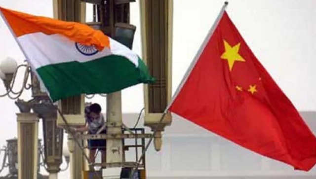
Much has been spoken about the India-China boundary issue since the incidents of Doklam and Galwan took place. Indeed, the scrutiny of the press has largely been on these two sectors. The eastern sector, which according to this author is the most contentious, hardly ever hits the headline. One of the reasons for the “neglect” is because of the relative quietitude that reigns in the sector, the credit for which must go to the military leadership of the Eastern Army Command. L’affaire Yangtse was one occasion when the Chinese sought to occupy the high ground. But as this author has written in an earlier column, the bravehearts of the Indian Army made the Chinese beat a hasty retreat. There is a sub-sector to the far east in Rest-of-Arunachal Pradesh (RALP). It is the Walong sector which is located around 30 km south of the India-China border in Arunachal Pradesh near a village called Kibithu. Kahao — the easternmost village of India — is located to the east of Kibithu. Lohit river, later known as the Kamlang River and finally, the Brahmaputra, enters Arunachal Pradesh near Kibithu and flows in a southerly direction. The border with China runs from west to east slightly ahead of Kibithu along the Dichu River. The high ridges on either side of the river are held by the Indian Army virtually making it impossible for any ingress by the Chinese PLA. The alignment of the boundary around this area is however disputed in the sense that there is a difference of interpretation about the exact alignment of the boundary. McMahon’s thick nib pen and his haste to draw a boundary without proper survey is the reason for much of the border ails between the two Asian giants. Just ahead of the Dichu river is a place called the Madan Ridge dominating both the Dichu river and an area north of the ridge. In the perception of India, the alignment of the boundary runs along the crest of the Madan ridge. But the Chinese consider Madan ridge as part of their territory for the obvious reason that any movement up to the Madan ridge by the PLA from the north will not be noticed except from Indian posts located on top of the ridges on either side of the Lohit river. Therefore, should the Chinese interpretation of the alignment be accepted, it would mean that the PLA would have an unhindered run right up to the Madan Ridge. Even though this might not assure the PLA a permitted free run further south, holding on to a higher ridge will be of tremendous military advantage to the PLA. On the other hand, the holding of the Madan ridge by the Indian Army along with the ridges on either side of the Lohit River will tilt the balance of defensive posture towards India. However, for some reason or the other — perhaps simply not to up the ante — the Indian Army’s movement up to the south of the Dichu River is restricted, leaving the Madan Ridge to the PLA. The PLA routinely visits Madan ridge to assert their claim, leaving in the process “tell-tale signs”. This author (a decade ago) climbed all the way to the Dichu Observation Post. The trek was an imaginably arduous one, especially as he has metallic implants on his right leg, a result of an almost fatal fall in an Indian army battalion while undertaking “adventure sport”. This column wants to concentrate on a controversial terminology which is termed as “limits of patrolling” in Indian Army parlance. Indeed, it has been the proverbial gripe for the Indian Army. The “limits of patrolling” is determined by the “China Study Group”, of which the Indian Foreign Secretary used to be the chairman. But after the Galwan event, it has been understood that the National Security Adviser has taken over as the head of this important group. But most people who have some knowledge about India-China boundary relations query as to why the “Group” disallows Indian Army patrolling to be undertaken in the general area of Madan Ridge, and perhaps even elsewhere along the 3,488 km long Line of Actual Control (LAC). The most convenient answer is that it might “up the ante” were the Indian army patrols to “cross” into what the Chinese perceive as their territory. China has, of course, been continually accusing India of deploying troops in areas which are perceived as sensitive “ground of both vital and tactical importance”. The Doklam crisis brought the apprehension out into the open. The attempt by the Chinese to construct a road all the way to the Jampheri ridge would have threatened the Siliguri Corridor. The people of India constantly fed by the probing media are aware of the peril. But the Madan Ridge, which is as special, has never found adequate mention in mainstream media. The 1962 war was a debacle. India was not prepared and a war was lost as a result. The “Battle of Walong” is one such story. The Indians actually fought very well in the area and there was a great loss to the PLA in what is known as the “Tiger’s Mouth”. Four hundred Chinese soldiers died in the Namti Defences in what is euphemistically called the “Tiger’s Mouth”. The Madan ridge is one of the areas China claims. In fact, the ridge is important to both armies. While Indian Army has stopped patrolling in the general area of Madan ridge, it is well entrenched in guarding that approach and it is ensured that 1962 will not be repeated. What however will happen in the event of an outbreak of a full-fledged conflict is a matter of military exigency and one does not have an insight into such a plan. But the fact of the matter is that the villagers who reside in the remotest of hamlets right on the border (disputed or not) are very friendly and are emotionally attached to the Indian Army in the sector. Kahao, a quaint little village, is one such village which is one of the first places in India to witness the sunrise. The inhabitants of the village are called Meyors and they are a very friendly lot. This author stopped in the village for a mug of village brew on his way up to the Dichu Observation Post. This author still recalls slashing up his left palm while crossing a Foot Suspension Bridge over the Lohit River. It was perhaps nature’s way of paying tribute to the “Red River” for which Lohit is known as. The bridge allows only one man at a time to cross over and the manner in which it swings along with the wind that blows across the Lohit River is both breathtaking and terrifying. After reaching the top (Observation Post Dichu), which took this author a good four hours trek, he was amazed at the view from the Chinese side. It was both overwhelming and forbidding: a small bridle path on the Indian side which took him close to four hours to climb up and the Chinese complete with radars and a smooth metalled “Class-9” road that linked Tatu with their tactical garrison in Rima and further afield. The PLA cadres fall in exactly at 9:50 am (Indian Standard Time) which coincides, one was told, with lunch hour by Beijing Time. In any event, the question which crossed one’s mind (at the time when the author visited the area) is why the powers that be in India had not constructed a proper, concrete bridge in place of the Foot Suspension Bridge over the Lohit. After all, it was rather strange that only one person could go across the swirling overpass at a time. What would happen in an emergency or were the PLA to catch the Indian side by surprise? The strange rationale, it was informed, was that it is better to keep the Indian border areas inaccessible in order not to give a free run to an invading enemy. Further, better connectivity also entails creating additional logistical infrastructures. All of which come at a cost. So was the case in the Walong sector. In Kibithu, the suspension bridge over the Lohit River is the only connectivity from west to east. Lack or lack of reliance on connectivity between two localities separated by a water obstacle creates a sense of unfounded fear among the troops and it will be the general tendency to pull back the troops under a secure wing at the earliest opportunity. It was probably the reason why the Indian Army pulled back prematurely in 1962. However, good sense has prevailed and a new bridge has come up further south of the suspension bridge near a village called Messaih. This bridge is motorable and is hidden from enemy observation and out of direct firing range. The Indian Army is presently better poised to face a situation if the enemy were to destroy the old bridge called FSB 17 and isolate the troops in the Eastern bank of the river from those on the Western bank. The long and short of it is that much development has happened in the Eastern Sector during the last couple of years. It has been fortified with new axes (although robust laterals are yet to see the light of day) and even advanced landing grounds have come up near the LAC as a result of Exercise Gagan Shakti. However, one aspect that needs to be looked into with utmost urgency is the widening and double-laning of the roads, especially in the Walong and the Subansiri sub-sectors. Inclement weather plays havoc every rainy season and traversing a road to say an area such as Tuting is a harrowing experience.< The 1962 debacle happened because the realities were given a go-by. This cannot — and should not — be allowed to happen again. This is unacceptable. The writer is a conflict theorist and bestselling author. Views expressed in the above piece are personal and solely that of the author. They do not necessarily reflect Firstpost’s views. Read all the Latest News, Trending News, Cricket News, Bollywood News, India News and Entertainment News here. Follow us on Facebook, Twitter and Instagram.
Comprehending the realities of India-China border: Easter Sector has seen development, but more needs to be done
Jaideep Saikia
• July 21, 2023, 19:26:37 IST
One aspect that needs to be looked into with utmost urgency is the widening and double laning of the roads, especially in the Walong and the Subansiri sub-sectors
Advertisement
 "Comprehending the realities of India-China border: Easter Sector has seen development, but more needs to be done")
End of Article