
 "Sagar Sampark: Indigenous global navigation system for ships inaugurated")
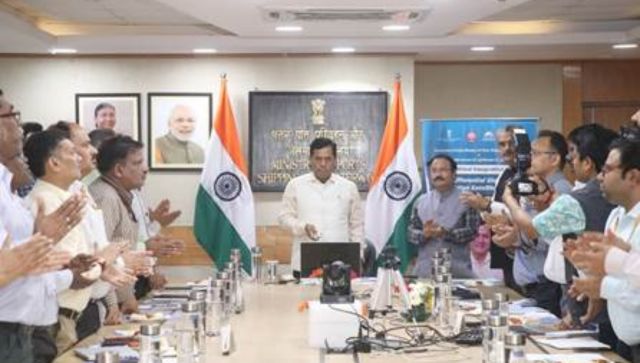
Aiming to boost the digitalisation in the maritime sector, the Union Minister of Ports, Shipping and Waterways Sarbananda Sonowal on Wednesday inaugurated an indigenous Differential Global Navigation Satellite System (DGNSS) called Sagar Sampark. Sagar Sampark is an enhancement system that “corrects the errors and inaccuracies in the Global Navigation Satellite System (GNSS) and provides more accurate positioning information”, the shipping ministry said. Union Minister of Ports, Shipping and Waterways, Sarbananda Sonowal inaugurated the indigenous Differential Global Navigation Satellite System (DGNSS) which is a terrestrial-based enhancement system which corrects the errors and inaccuracies in the navigation satellite System allowing for more accurate positioning information. Speaking on the occasion, Sarbananda Sonowal said that his ministry has given high priority to the safety of Navigation, especially due to the considerable increase in shipping volume in the recent past. He said, the launch of ‘Sagar Sampark - Differential Global Navigation Satellite System (DGNSS)’ at 06 locations under DGLL, will definitely enhance the capability of the DGLL in the field of radio aids to Marine Navigation.’ The DGNSS service will help mariners in safe navigation and will reduce the risk of collisions, groundings, and accidents in the port and harbour areas. This will lead to the safe & efficient movement of vessels. Speaking on the occasion, Shripad Y. Naik said ‘DGNSS is an important Radio Aid to Navigation towards the fulfilment of international obligations of the International Maritime Organisation (IMO), Safety of Life at Sea (SOLAS) and International Association of Marine Aids to Navigation and Lighthouse Authorities (IALA)’. After recapitalization with multiple satellite constellations like GPS and Global Navigation Satellite System (GLONASS), DGNSS further increases the availability and redundancy as per international standards and helps the mariners to improve their positioning within 5 meters. The latest DGNSS system is now able to transmit corrections of GPS and GLONASS. The DGNSS significantly improves the accuracy of GPS positioning, reducing errors caused by atmospheric inferences, satellite clock drift and other factors. This is achieved with the help of modern state of art technology receivers and the latest software. The error correction accuracy has been improved from 5 to 10 meters to less than 5 meters for 100 Nautical Miles from Indian coastlines.
Sagar Sampark is an enhancement system that “corrects the errors and inaccuracies in the Global Navigation Satellite System (GNSS) and provides more accurate positioning information”, the shipping ministry said.
Advertisement
End of Article
Written by Chandan Prakash
Chandan Prakash is a Chief Sub-Editor with Firstpost. He writes on politics, international affairs, health, business and economy. If you have story ideas/pitches, reach him at Chandan.Prakash@nw18.com see more

 "Russian drones over Poland: Trump’s tepid reaction a wake-up call for Nato?")
 "As Russia pushes east, Ukraine faces mounting pressure to defend its heartland")
 "Why Mossad was not on board with Israel’s strike on Hamas in Qatar")
 "Turkey: Erdogan's police arrest opposition mayor Hasan Mutlu, dozens officials in corruption probe")


