
 "Low pressure area formed over Bay of Bengal likely to intensify into cyclonic storm by 16 May, warns IMD")
New Delhi: Monsoon is likely to reach the Anadman and Nicobar archipelago around 16 May, nearly six days before its normal onset date, due to a cyclonic circulation in the Bay of Bengal, the India Meteorological Department said on Wednesday. Monsoon usually covers the Andaman and Nicobar islands around 20 May. The onset date for Andaman and Nicobar was last month revised to 22 May. It then normally takes 10-11 days to reach Kerala which marks the commencement of rainfall season in India. [caption id=“attachment_8364391” align=“alignleft” width=“380”] 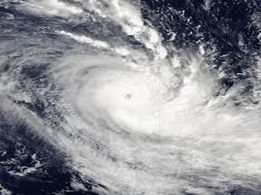 Representational Image. ANI[/caption] However, monsoon is now likely to reach Andaman and Nicobar around 16 May. The IMD is also likely to release the possible onset date over Kerala later this week. A low pressure area, the first step in the formation of a cyclone, was formed over southeast Bay of Bengal and adjoining south Andaman Sea on Wednesday morning, the IMD said. It is very likely to concentrate into a depression over the central parts of south Bay of Bengal on 15 May and further intensify into a cyclonic storm over southwest and adjoining west-central Bay of Bengal by the evening of 16 May. “In association with the system (cyclone), the conditions will become favourable for advance of southwest monsoon over south Bay of Bengal, Andaman Sea and Andaman & Nicobar islands around 16 May,” the IMD said. Under its influence, adverse weather is likely over south and central Bay of Bengal and the Andaman Sea from 15 May onwards. The system is under continuous surveillance and the state governments concerned are being informed regularly, the Cyclone Warning Division added. Mrutunjay Mohapatra, director general of the IMD, said the cyclone will aid in advancement of the monsoon, which is likely to be normal this year. The onset date of monsoon over Kerala is 1 June, which marks the commencement of the four-month long rainfall season in the country. From this year, the IMD has also revised the dates of onset and withdrawal of the monsoon for several parts of the country based on the data from 1960-2019. The previous dates were based on the data from 1901 to 1940. However, the onset date for monsoon over Kerala remains unchanged, Rajeevan said. In states like Maharashtra, Gujarat, Madhya Pradesh, Chhattisgarh, Telangana, Andhra Pradesh, Odisha, Jharkhand, Bihar and parts of Uttar Pradesh, monsoon will be delayed by 3-7 days compared to the existing normal dates. For the national capital, the new normal onset date for monsoon has been revised from 23 June to 27 June . Similarly, dates have been revised for Mumbai and Kolkata from 10 to 11 June , and for Chennai from 1 to 4 June. However, over extreme northwest India, the monsoon will arrive a little early, on 8 July, rather than the expected date of 15 July. The new date for monsoon withdrawal from south India is 15 October.
A low pressure area, the first step in the formation of a cyclone, was formed over southeast Bay of Bengal and adjoining south Andaman Sea on Wednesday morning, the IMD said.
Advertisement
End of Article

 "Charlie Kirk, shot dead in Utah, once said gun deaths are 'worth it' to save Second Amendment")
 "From governance to tourism, how Gen-Z protests have damaged Nepal")
 "Did Russia deliberately send drones into Poland’s airspace?")
 "Netanyahu ‘killed any hope’ for Israeli hostages: Qatar PM after Doha strike")


](https://images.firstpost.com/wp-content/uploads/2020/05/cyclone_ANI-380.jpg)