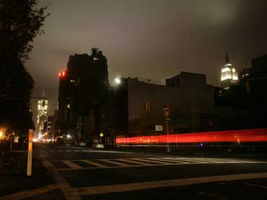
New York: Over a week after the superstorm Sandy battered the US east coast, another significant storm is forecast to hit already-ravaged New York and New Jersey states bringing in high winds, storm surge and snow in some areas. The storm, termed as the Nor’easter, could impact New York City today through Thursday morning. The storm could bring an inch of rain and sustained winds will reach 25 to 40 miles per hour, with gusts up from 55 to 65 miles per hour. National Weather Service said the low pressure system off the Mid-Atlantic coast would continue to strengthen as it moves north, bringing rain and snow to areas across the northern Mid-Atlantic and Northeast, as well as wind gusts as high as 60 mph along the coast. [caption id=“attachment_518471” align=“alignleft” width=“380”]  AP[/caption] Snowfall across interior sections of New England could approach 6-12 inches and coastal flooding is also possible. The wind is forecast to cause a storm surge ranging from three to five feet at high tide today, with the highest surge levels forecast for the Western Long Island sound. While no general evacuations have been ordered, the city is advising people who experienced significant flooding during Hurricane Sandy to take shelter with family and friends who do not live in low-lying areas. In particular, residents of Breezy Point, Hamilton Beach, and Gerristen Beach should consider taking shelter with family or friends or at a city-run shelter, city Mayor Michael Bloomberg said. New York is taking significant precautions ahead of the new storm, including halting construction, closing city parks, encouraging drivers to stay off the road after 5 pm and urging people without heat to take shelter to stay warm. As a precautionary measure, airlines canceled 770 flights into and out of the New York area. The storm is being considered significant and under “normal circumstances” would have resulted in minor coastal flooding in low-lying areas, and the normal risk of downed trees. However, given that hurricane Sandy weakened trees and caused extensive damage and debris, the predicted wind speeds from the new storm present an increased risk of more downed trees and tree limbs, as well as windblown debris. “All New Yorkers are urged to stay indoors during inclement conditions,” Bloomberg said. Due to the beach erosion and other damage caused by hurricane Sandy, some of the lowest-lying areas in the city, particularly the areas flooded by last week’s storm are vulnerable to storm surge today. The new storm comes just as New York and New Jersey, the two states worst hit by Sandy, were limping back to recovery. Sandy, one of the worst storms to hit the US eastcoast, had wrecked havoc across the region killing over 100 people. It brought the mass transit system to a grinding halt, left millions without power for days in cold weather and caused billions of dollars of economic damage. PTI
Over a week after the superstorm Sandy battered the US east coast, another significant storm is forecast to hit already-ravaged New York and New Jersey states bringing in high winds, storm surge and snow in some areas
Advertisement
End of Article
Written by FP Archives
see more


)

)
)
)
)
)
)
)
)


