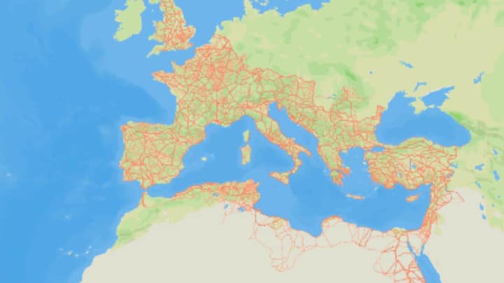
Google Maps for ancient Rome: Digital archaeology brings 2,000-year-old highways back to life
Researchers have mapped the Roman Empire's road network, revealing 300,000 km of roads, including 110,000 km newly discovered. Available on itiner-e.org, the map spans from the British Isles to the Arabian Peninsula, enhancing understanding of ancient mobility and disease spread.