
 "Why Russia earthquake set off tsunami alerts across US")
The 8.8 magnitude earthquake in Russia set off alarm bells in many parts of the world including Japan and the United States.
The earthquake hit the Kamchatka Peninsula in Russia’s far east.
This area is part of the Pacific Ring of Fire – a huge stretch of active and dormant volcanoes that spans most of the Pacific Ocean.
Around 90 per cent of all earthquakes occur here. The region is home to around 75 per cent of all active volcanoes.
But hours after the earthquake, thousands of kilometres away, tsunami waves began hitting Hawaii.
Alerts also sounded for Alaska and other parts of the United States.
But how did the quake in Russia put the US on alert? What parts of US have been hit? What’s the damage?
Let’s take a closer look:
Why quake in Russia put US on alert
The earthquake struck the Kamchatka Peninsula in Russia’s far east on Wednesday morning. It was approximately 11.24 am.
But when the waves hit Hawaii thousands of kilometres away it was still Tuesday. So, how did this happen?
Because the waves, in a sense, travelled back in time.
They did so because they crossed the International Date Line in the Pacific Ocean.
But what explains how the waves made it across the world?
This is chalked up to the sheer power of the quake.
This tremor was the most powerful since the 2011 one in Fukushima, when a 9.1-magnitude tremor left 18,000 dead and caused a meltdown in a nuclear reactor.
Experts say such quakes occur just once a year on average.
We also need to understand how the quake occurred.
The Earth’s crust comprises pieces called tectonic plates that are joined together.
They drift atop hot, melted rock.
The areas where the plates slide under each other are called subduction zones.
The Ring of Fire , as noted, sees most of the world’s earthquakes occur. This is because of the movements of tectonic plates.
According to scientists, subduction zones can “stick” for a long time, building up pressure. When the plates suddenly “slip,” that pressure is released as an earthquake.
The Kamchatka region in Russia is near two major subduction zones, where the Pacific Plate is sliding under the North American Plate.
This area is known for big earthquakes —one in 1952 reached magnitude 9.0.
The recent earthquake likely involved a huge movement along the fault line—up to 320 to 480 kilometres long. It happened just 20 kilometres miles below the ocean floor.
This shifted part of the seafloor upward, which in turn pushed a large amount of ocean water.
Thus, a tsunami was born and began moving across the Pacific Ocean, heading toward the United States.
Experts said the waves travelled to the United States between 500 and 800 kilometres per hour – the speed of a jet plane.
However, these waves slowed down once they reached in shallow waters.
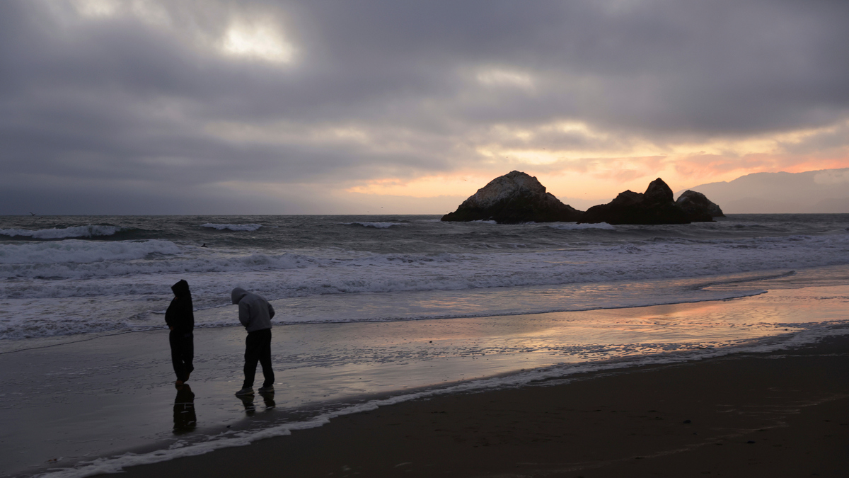
Hawaii and the West Coast were affected because they sat directly across from the Kamchatka Peninsula.
The waves reached Hawaii at 7.10 pm local time – around six hours after the quake struck.
Parts of Alaska and the West Coast were also put on tsunami watch.
Which parts of the US have been hit? What’s the damage?
The waves hit parts of Hawaii, Alaska and the West Coast of the US**.**
Authorities sounded evacuation warnings for Hawaii where a four-foot wave was seen off the island of Oahu, while a wave more than 5-feet high was witnessed in Maui’s Kahului.
Hawaii Country’s Hilo witnessed a 4.5-foot tsunami wave, while Hanalei Guage recorded waves of up to 3.9 foot wave.
Even Oprah got in the act with Maui County saying that she had opened up her private road to help citizens flee.
“Oprah’s road is open to get Upcountry, according to Maui Police Department,” the county said.
Hawaii Governor Josh Green had urged residents and tourists to stay calm and follow evacuation instructions, while the US Coast Guard shut key ports across the Hawaiian Islands.
Thankfully, the tsunami warning was downgraded to an advisory level by around 11 pm.
Flights have resumed at the Honolulu International Airport.
The evacuated have been advised to return to their homes.
Hawaii has witnessed no major injuries or damage.
In Alaska, the communities of Amchitka and Adak witnessed waves of around 2.7 feet.
Alaska Airlines also began delaying flights and rerouting those already in the air. The airline urged passengers to check their flight status before heading to the airport.
Alaska, like Hawaii, witnessed no significant damage or injuries.
The tsunami reached the California coast around 3 am on Wednesday.
A four feet, 4-inch wave was seen in Arena Cove.
Crescent City, a coastal town around 30 kilometres from Oregon, witnessed a four-foot wave.
The town of less than 7,000 residents has been hit nearly three dozen times by tsunami waves since 1933.
A 1964 incident left 11 dead and nearly 30 city blocks ruined.
A small part of the West Coast – from Cape Mendocino to the Oregon border – is under tsunami warning.
This is the highest level of alert possible.
It means widespread flooding across the coast is likely or is already happening.
Residents are advised to evacuate.
Most of the West Coast including Los Angeles and San Francisco, Hawaii and Alaska coastline are now under tsunami advisory.
This means that “strong currents or waves dangerous to those in or very near the water” are possible.
Here, residents are advised to stay away from beaches and waterways.
With inputs from agencies
 "Russian drones over Poland: Trump’s tepid reaction a wake-up call for Nato?")
 "As Russia pushes east, Ukraine faces mounting pressure to defend its heartland")
 "Why Mossad was not on board with Israel’s strike on Hamas in Qatar")
 "Turkey: Erdogan's police arrest opposition mayor Hasan Mutlu, dozens officials in corruption probe")


