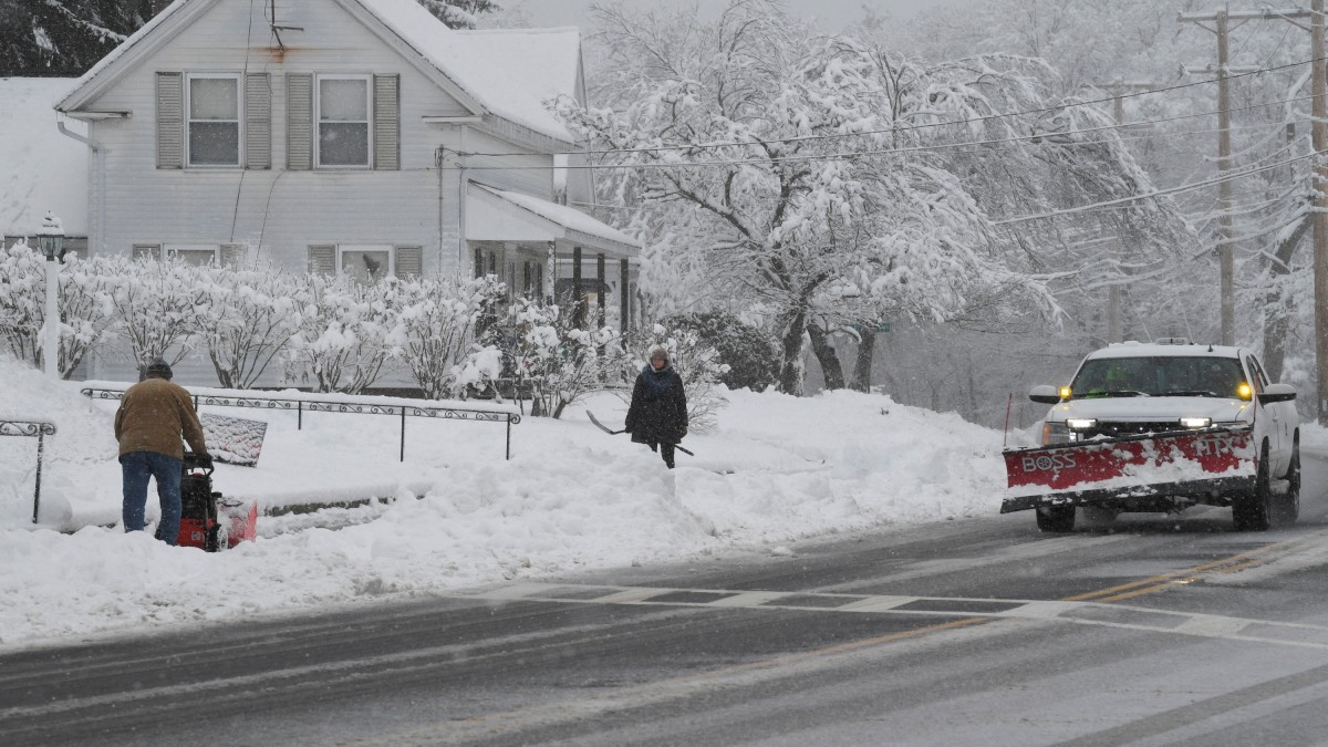
 "People use shovels and snow blowers to clear snow during the first winter storm of 2024 which is expected to bring heavy snowfall across the northeast United States, in Grafton, Massachusetts, US. Reuters")
This winter will be dangerously cold in the United States.
Over the coming days, the eastern two-thirds of the country will be swept by multiple bursts of increasingly severe cold Arctic air .
After last year’s hottest winter on record and a warm spell, temperatures will probably plunge to dangerously low levels by next week.
The reason for this is the polar vortex, a powerful upper atmosphere phenomenon.
Here’s all we know about it.
Polar vortex meaning
The US-based National Weather Service (NWS) defines the polar vortex as “a large area of low pressure and cold air” that encircles both of the Earth’s poles.
It is usually found close to the poles; however, it gets weaker in the summer and stronger in the winter.
The counter-clockwise air movement that keeps the colder air close to the poles is referred to as a “vortex.”
The polar vortex often expands throughout the northern hemisphere’s winter, pushing cold air southward with the jet stream.
This happens rather frequently in the winter and has been linked to significant Arctic air outbreaks in the US.
The January 2014 cold outbreak is comparable to numerous previous cold outbreaks, including some of the more significant ones that happened in 1977, 1982, 1985, and 1989.
Also read: Cold Christmas: What’s causing the winter storm in US that’s disrupting holiday plans?
Freezing temperatures in January
Even though it is already usually the coldest time of year, CNN reports that the temperatures are expected to be the lowest of the winter so far.
More than 70 per cent of the nation’s population will endure freezing temperatures over the next week, indicating how widespread the cold will be.
The eastern part of the country will experience the hardest blow next week, with temperatures in some areas dropping as much as 30 degrees below average.
This will be a major change from the record-breaking warmth of the winter of last year.
It is anticipated that the cold will persist until the second weekend of January. As a result, the environment may be set to deliver snow and ice, possibly in areas that do not normally get it.
Although snow and ice are not always certain when it is cold, a disruptive storm containing both is expected this weekend and early next week.
By the end of the week, the exact path, effects, and timing of the storm will become clear.
Regions to be affected
The NWS has warned that “the coldest air of the season to date and dangerous wind chills are likely across many areas of the southeast.”
The first half of January is predicted to have temperatures on the East Coast and in the southeast remain below normal.
Temperatures below freezing may also occur in Florida and the Gulf of Mexico.
In addition to severe wind chills, weather experts are forecasting a lot of snow in the Great Lakes region and into the Appalachians.
The north-central America will experience its first cold air surge on Wednesday, with highs in the single digits or teens predicted for areas of Minnesota, Montana, and the Dakotas.
As has been the case since at least the fall, the West will mainly be left out of any significant cold.
By Friday, Chicago’s maximum temperature will remain in the mid 20s, which is roughly 10 degrees below the average for the first few days of January. Cincinnati, St. Louis, Kansas City, and Missouri could all see high temperatures that are close to freezing.
Millions of people will experience bitterly cold temperatures on Saturday morning (January 4). Nebraska, Iowa, and Illinois may have single-digit lows, while northern North Dakota may experience lows of up to 25 degrees below zero.
According to NWS, Tuesday night lows might drop as low as minus four degrees Celsius in Georgia and minus eight degrees Celsius in certain areas of Texas.
By that time, it is expected that heavy snow would spread from the Great Lakes region into the central and eastern US, with the possibility of snowfall as far south as Texas.
Threat levels
News of a polar vortex should not worry people, according to the NWS, but they “should be prepared for colder temperatures” than usual.
Although the US’s northern regions are used to harsh winters with plenty of snow, winds from the Canadian Arctic could bring dangerously low temperatures of minus 29 to minus 34 degrees Celsius.
In as little as 30 minutes, this might result in frostbite on exposed skin.
This might be dangerous for anyone without access to heat or shelter, especially overnight.
Moreover, as per BBC, a severe Arctic winter storm in 2022 left 1.5 million houses without power, caused extensive disruption throughout the US, and claimed multiple lives.
A dozen Gulf Coast facilities also briefly ceased to produce oil as a result of the storm.
With inputs from agencies