
 "Why Nepal has a problem with India-China trade through Lipulekh Pass")
The boundary issue has once again flared up between India and Nepal. New Delhi has strongly reacted to Kathmandu’s objection to the resumption of border trade between India and China through Lipulekh Pass.
India dubbed Nepal’s territorial claims to the Lipulekh Pass as “unjustified and untenable.” Nepal earlier expressed displeasure with India over its decision to reopen trade with China through the Himalayan pass, a route that covers Lipulekh, Limpiyadhura, and Kalapani.
Let’s take a closer look.
What did Nepal say?
India and China have decided to reopen border trade through three designated trading points — Lipulekh Pass in Uttarakhand, Shipki La Pass in Himachal Pradesh, and Nathu La Pass in Sikkim. The development came during Chinese Foreign Minister Wang Yi’s visit to India earlier in the week.
After the announcement, Nepal objected to the resumption of border trade between the two countries through Lipulekh Pass, which it claims is its territory.
“The Nepalese government is clear that the official map of Nepal has been included in the constitution of Nepal and that the map shows Limpiyadhura, Lipulekh and Kalapani east of the Mahakali River as integral parts of Nepal,” the Nepal foreign ministry said on Wednesday (August 20).
“It is a well-known fact that the Nepal government has been requesting the government of India not to construct or expand roads and indulge in any kind of activity such as border trade in the territory,” the statement by the spokesperson of the foreign ministry, Lok Bahadur Chhetri, read.
“It is also well known that the Nepal government has already informed the government of China that the area lies in Nepalese territory,” it added.
“The Nepal government is committed to resolving the border issue between the two countries through diplomatic channels on the basis of historical treaty - agreement, facts, map and other evidence complying with the spirit of cordial and friendly relations existing between Nepal and India,” read the statement.
Impact Shorts
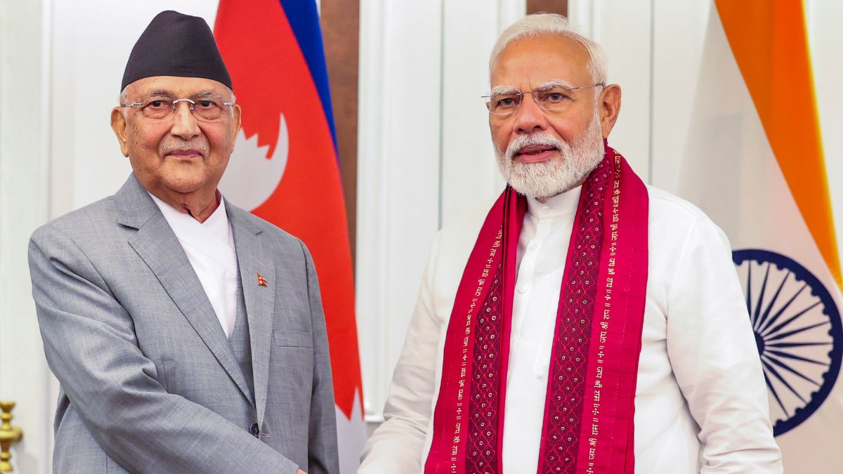
More ShortsNepal’s objection came even as Indian Foreign Secretary Vikram Misri visited the country between August 17-18 and invited Prime Minister KP Sharma Oli to visit India in September.
Moreover, India and Nepal on Wednesday jointly inaugurated two bridges constructed with grant assistance from New Delhi in Koshi province.
“India has promised to provide 10 prefabricated steel bridges to Nepal under grant assistance for rebuilding critical road infrastructure disrupted by rains and for bolstering connectivity following the September 2024 floods,” the Indian Embassy in Kathmandu said in a press release.
How India reacted
India hit back at Nepal’s territorial claims, saying they were not based on “historical facts”.
“Our position in this regard has been consistent and clear. Border trade between India and China through Lipulekh Pass had commenced in 1954 and has been going on for decades. This trade had been disrupted in recent years due to COVID and other developments, and both sides have now agreed to resume it,” said Ministry of External Affairs (MEA) Spokesperson Randhir Jaiswal.
“As regards territorial claims, our position remains that such claims are neither justified nor based on historical facts and evidence. Any unilateral artificial enlargement of territorial claims is untenable,” he said.
In response to media queries regarding comments made by Nepal on border issue, Official Spokesperson Shri Randhir Jaiswal says "We have noted the comments of Ministry of Foreign Affairs of Nepal related to resumption of border trade between India and China through the Lipulekh… pic.twitter.com/9UNQ6u2iWM
— ANI (@ANI) August 20, 2025
“India remains open to constructive interaction with Nepal on resolving agreed outstanding boundary issues through dialogue and diplomacy,” Jaiswal added.
Even in 2015, Nepal had objected to an agreement between India and China to include the Lipulekh Pass as a bilateral trade route.
India-Nepal border dispute
India and Nepal share a 1,800 km open border.
Kathmandu claims Lipulekh, Limpiyadhura and Kalapani near the trijunction of India, Nepal, and China.
Nepal disputes the areas, which are under India’s control, based on the 1816 Treaty of Sugauli, which established the Kali River as the demarcation line for the boundary with India.
The Kali River has two tributaries — one beginning at Lipulekh and the other at Limpiyadhura.
Kathmandu claims the river originating in Limpiyadhura as the western border, while New Delhi asserts the boundary begins from Lipulekh.
Lok Raj Baral, a former Nepali diplomat, told Al Jazeera that the disputed land lies between the two rivers. He said that the boundary issue stems from a lack of maps published by Nepal.
“Nepal did not have the capacity to produce maps, so it depended on maps published by the British India. The first boundary claim by Nepal was made in 1962,” he said.
Last year, Nepal announced a new currency note featuring a map showing Kalapani, Lipulekh and Limpiyadhura. India had rejected the map, saying the “unilateral actions” would not change the ground reality.
This was not the first time that Kathmandu displayed the areas within its territory. On June 18, 2020, Nepal revised its new political map with these three strategic regions. The move was dismissed by India as “untenable”.
That year, Nepal also protested India’s inauguration of a new 80-kilometre road leading to the Lipulekh Pass. This link serves as the shortest route between New Delhi and Kailash-Mansarovar.
In 2019, New Delhi published a new map exhibiting Kalapani within its borders, a move criticised by Kathmandu.
With inputs from agencies
 "Russian drones over Poland: Trump’s tepid reaction a wake-up call for Nato?")
 "As Russia pushes east, Ukraine faces mounting pressure to defend its heartland")
 "Why Mossad was not on board with Israel’s strike on Hamas in Qatar")
 "Turkey: Erdogan's police arrest opposition mayor Hasan Mutlu, dozens officials in corruption probe")


