
 "Explained: Why Mount Everest is getting taller")
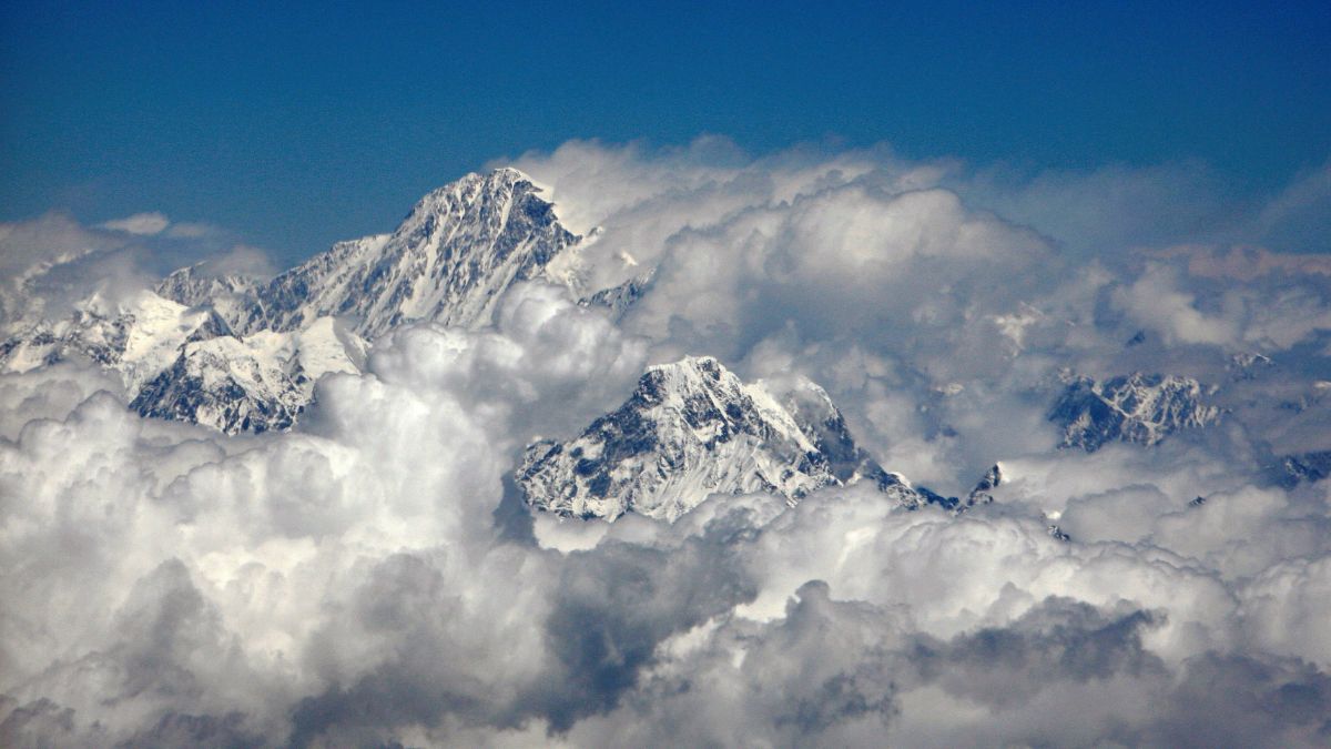
Mount Everest, the world’s highest peak, is growing taller every year. Known as Chomolungma in Tibetan and Sagarmatha in Nepali, it began to form nearly 50 million years ago, when the Indian subcontinent collided with the Eurasian tectonic plate.
Now, experts say that Everest which towers at 8,849 metres (29,032 feet) is witnessing a growth spurt. They say this increase has been more than expected.
So, what explains Mount Everest’s growth spree? Let’s understand.
What we know
A study published in the journal Nature Geoscience on Monday (September 30) shows Mount Everest has risen 15 to 50 metres in height over the last 89,000 years.
It says the process continues even now, with Everest growing around 2 millimetres per year compared to the expected yearly surge of 1 millimetre.
“Mount Everest is a remarkable mountain of myth and legend and it’s still growing,” Adam Smith, a co-author of the study and a PhD student at University College London (UCL) Earth Sciences, said.
According to Jin-Gen Dai, a geoscientist at the China University of Geosciences in Beijing, who authored the study, Everest, which extends about 250 metres above the Himalayas’ other tallest peaks, is an anomaly.
“Although mountains may appear to stand still from the perspective of a human lifetime, they are in fact constantly in motion,” he said, as per New York Times (NYT).
Reasons behind Everest’s growth spurt
Mount Everest, which stands on the border between Nepal and the Tibet Autonomous Region of China, is growing due to an act of “piracy”, or “river capture”.
Around 89,000 years ago, the Kosi River in the Himalayas captured a part of its tributary the Arun River, which lies to the north of Everest today. Matthew Fox, study co-author and geologist at UCL, told The Washington Post that the rare “river capture event” happens when a river changes its course, interacts with another and steals its water.
Researchers say as the two rivers merged, it boosted river erosion near Everest carrying off huge amounts of rock and soil. This led to the formation of the Arun River gorge.
“An interesting river system exists in the Everest region,” Dai, one of the authors of the study, said.
“The upstream Arun river flows east at high altitude with a flat valley. It then abruptly turns south as the Kosi river, dropping in elevation and becoming steeper. This unique topography, indicative of an unsteady state, likely relates to Everest’s extreme height,” he added.
As the Arun River became part of the Kosi River system, the two grew more erosive and the rocky mass started crumbling. Over millennia, the Arun River washed away billions of tonnes of sediments and earth along its banks, carving the large gorge.
The loss of huge amounts of sediment caused the uplift of surrounding land, known as isostatic rebound.
“Isostatic rebound can be likened to a floating object adjusting its position when weight is removed,” geoscientist Dai was quoted as saying by Reuters.
“When a heavy load, such as ice or eroded rock, is removed from the Earth’s crust, the land beneath slowly rises in response, much like a boat rising in water when cargo is unloaded,” he added.
According to the researchers, the isostatic rebound is responsible for about 10 per cent of Everest’s annual uplift rate.
Why it matters
Authors of the study say that the rebound has also affected other Himalayan peaks, such as Lhotse and Makalu, the world’s fourth and fifth highest peaks respectively, which have seen a similar uplift.
Researchers believe that Makalu, which is closest to the Arun River, would get an even more boost.
“This effect will not continue indefinitely. The process will continue until the river system reaches a new equilibrium state,” Dai said, as per The Guardian.
“This research underscores our planet’s dynamic nature. Even a seemingly immutable feature like Mount Everest is subject to ongoing geological processes, reminding us that Earth is constantly changing, often in ways imperceptible in our daily lives,” he told Reuters.
Climbing Everest is an uphill task, to say the least. With the summit growing every year, scaling it could become more challenging as the extra height may result in more ice growing at higher elevations. Fox, the study’s co-author, told The Washington Post that “the biggest impact is probably on the climbers that have to climb another 20 metres or so to the top.”
Speaking to The Guardian, Professor Mikaël Attal of the University of Edinburgh, who was not involved in the work, said river capture is a well-known process but it was comparatively rare.
“What is unique in this study is the demonstration that erosion resulting from river capture can lead to such a dramatic response of the Earth’s surface, with an area the size of Greater London going up a few tens of metres in tens of thousands of years, which is fast.”
But not everyone is convinced by the findings of the study. Geologist Mike Searle, who was not part of the research, told The Washington Post that river capture is common near active mountain ranges but is difficult to link with uplift, especially if it occurs tens of kilometres away.
Other factors that explain the uplift are tectonics and the loss of mountain glaciers, Fox reportedly said.
With inputs from agencies

 "Russian drones over Poland: Trump’s tepid reaction a wake-up call for Nato?")
 "As Russia pushes east, Ukraine faces mounting pressure to defend its heartland")
 "Why Mossad was not on board with Israel’s strike on Hamas in Qatar")
 "Turkey: Erdogan's police arrest opposition mayor Hasan Mutlu, dozens officials in corruption probe")


