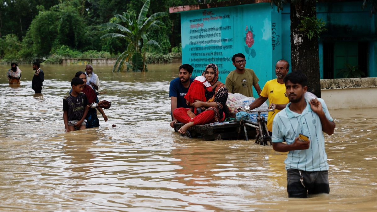
 "People move a cart with a woman and a child through a flooded street, amid severe flooding in the Fazilpur area of Feni, Bangladesh, August 26, 2024. Reuters")
Bangladesh is reeling from catastrophic floods that have claimed 23 lives and stranded about 1.24 million families in 11 districts. Torrential rainfall and overflowing rivers triggered the floods, forcing 470,000 people to take refuge in shelters.
Amid this, reports have emerged in Bangladesh blaming India for the flooding. They claim the deluge is partially a result of the opening of the Farakka barrage in West Bengal. New Delhi has rejected these charges.
What is the Farakka barrage? What is the fake news over it? Let’s understand.
Farakka Barrage treaty
India and Bangladesh share the waters of the Ganges at Farakka in West Bengal as per the 1996 Ganga Water Treaty. This agreement was necessitated after the commissioning of the Farakka barrage in 1975, as per The Telegraph.
The Farakka Barrage, situated on the Ganga River in Bengal’s Murshidabad district, lies about 18 km from India’s border with Bangladesh. Built at a cost of nearly $1 billion, the barrage was completed in 1970. Its operations officially began five years later.
Impact Shorts
More ShortsIndia constructed the Farakka barrage to divert water from the Ganges to the River Hooghly to maintain the navigability of the Calcutta port.
As negotiations continued between India and Bangladesh over the sharing of the Ganges water, Dhaka argued it should be regulated according to a mutual agreement as it is an international river.
In 1972, the two nations constituted a Joint River Commission (JRC) to discuss the terms of the water sharing.
Amid a dispute between the two sides, the then Bangladesh president, Ziaur Rahman, raised the barrage issue at the United Nations General Assembly (UNGA). The UNGA called on India and Bangladesh to resolve the issue consensually.
In November 1977, Babu Jagjivan Ram, the then-Indian deputy prime minister, travelled to Bangladesh and signed a pact to resolve the Farrakka issue, reported NDTV.
The two nations signed the Farakka water treaty on November 5, 1977, which provided the absolute flow figures of the Ganga water to be released by India to Bangladesh at Farakka over 10-day periods between January 1 and May 31 every year until 1982.
ALSO READ: First floods, now visas: How anti-India sentiment continues to grow in Bangladesh
Ganga Water Treaty
In 1996, India and Bangladesh signed an agreement, known as the Ganga Water Treaty, on the sharing of the waters of the Ganges at Farakka.
The treaty, which expires on December 12, 2026, states that upper riparian India would make efforts to protect the flow of water at Farakka.
It allows India to withdraw 40,000 cusecs of flow when the water availability at Farakka exceeds 75,000 cusecs. If it is 70,000 cusecs or below, the water is to be shared equally between the two nations.
The treaty guarantees 35,000 cusecs of water in alternate three 10-day periods to both countries from March 11 to May 10.
In June, a row erupted after West Bengal chief minister Mamata Banerjee alleged she was excluded from the talks between Prime Minister Narendra Modi and his then Bangladesh counterpart Sheikh Hasina on River Teesta and the 1996 Ganga Water Treaty. The Centre had rebuffed her claims of not being consulted over the water-sharing issue.
Fake news over Bangladesh floods
As media reports blamed India for the Bangladesh floods, New Delhi clarified its position.
External Affairs Ministry spokesperson Randhir Jaiswal said on Monday (August 26), “We have seen fake videos, rumours and fear-mongering to create misunderstanding. This should be firmly countered with facts.”
He said the Joint River Commission officials in Bangladesh receive relevant data on a “regular and timely basis, and it was done this time as well”.
“We have seen media reports of the opening of Farakka barrage gates that will allow the flow of over 11 lakh cusecs of water downstream of the river in its natural course into the Ganga/Padma river,” Jaiswal added.
The Ministry of External Affairs (MEA) spokesperson said this is a “normal seasonal development” prompted by the “increased inflow from heavy rainfall in the Ganga river basin catchment areas upstream”.
He further explained, “It is to be understood that Farakka is only a barrage and not a dam. Whenever the water level reaches the pond level, whatever inflow comes, that passes. It is merely a structure to divert 40,000 cusecs of water into the Farakka canal that is carefully done using a system of gates on the main Ganga/Padma river, while the balance water flows into the main river to Bangladesh.”
Last week, India had termed the reports in Bangladesh attributing the floods in certain parts of the country to the opening of a dam on the Gumti River in Tripura as “factually incorrect”.
Meanwhile, three images have gone viral on social media, claiming they were taken during the floods in Bangladesh. The posts also blame the opening of the Dumbur dam upstream of the Gumti river in Tripura for causing the floods in the neighbouring country. However, those images are not real and are generated by AI.
With inputs from agencies