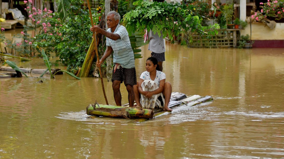
 "Flood-affected people use a makeshift raft to shift their lamb to a safer place following heavy rains at the Patiapam village in Nagaon district, in the northeastern state of Assam, July 3, 2024. Reuters")
Assam has been gripped by devastating floods again. About 16.50 lakh people have been affected in 29 districts as major rivers flow above the danger mark across the state.
The death toll due to floods, landslides and storms has risen to 56, while three people are reported to be missing.
Every year, Assam gets flooded during the monsoon. But why? Let’s understand.
Assam floods again
Eleven rivers, including the Brahmaputra, are flowing above the danger level across Assam, inundating roads and villages, embankments and farmlands.
An alert has been sounded in the Kamrup (Metro) district with vast tracts of land submerged.
About 80 per cent of the Kaziranga National Park, a UNESCO World Heritage site, is inundated by flood waters.
So far, 515 relief camps have been set up, with 25,744 displaced people taking shelter there.
Several agencies like the National Disaster Response Force (NDRF), State Disaster Response Force (SDRF), Fire and Emergency Services (F&ES), along with the Army and the paramilitary forces are engaged in rescue and relief operations.
Assam chief minister Himanta Biswa Sarma has termed the situation “chaotic and critical”.
“Very critical state awaits for Assam. We have been hit by massive floods. Lakhs of people have been affected until now and the numbers will increase in the next one week. Our rescue teams are on standby, ready to be deployed as necessary,” he said in a presss conference recently, as per News18.
On Wednesday (July 3), he blamed geographical factors for the flood situation. “The devastating second wave of floods in the state were mainly due to the cloudburst in neighbouring Arunachal Pradesh’’, Sarma told reporters.
Impact Shorts
More ShortsSarma said that heavy downpours in China, Bhutan and the upper reaches of Arunachal Pradesh caused floods in Assam, saying this is ‘‘beyond our control’’, as per PTI.
Assam’s grim reality
Assam is among India’s most flood-prone states. The southwest monsoon has led to flooding in low-lying areas of Assam for centuries due to which they are called ‘floodplains’, according to The Hindu report.
The National Commission on Floods state that 31.05 lakh hectares of the total 78.5 lakh hectares of the state, nearly 40 per cent of the land, is vulnerable to floods.
Overall, Assam accounts for 10 per cent of the total flood-prone area of India.
According to a report by the Indian Space Research Organisation (ISRO), 22.54 lakh hectares, about 30 per cent of Assam’s land, were hit by floods from 1998 to 2015.
Assam witnesses an average annual loss to the tune of Rs 200 crore due to floods.
Why does it happen?
The Northeast records intense rainfall every year.
Assam has a vast network of rivers, including the Brahmaputra and Barak River, and 50 tributaries. The state also gets river water from neighbouring Arunachal Pradesh and Meghalaya.
According to the Water Resources Ministry of Assam, 85 per cent of the annual precipitation in the Brahmaputra basin happens during monsoon months. “Besides the valley gets a good amount of rainfall in April and May due to thunderstorm activities which account for flood during heavy rain in June, when the soil is already saturated,” it said, as per The Hindu.
Besides its natural topography and excessive annual rainfall, Assam reports floods because of both man-made and natural reasons.
Riverbank erosion is one of the factors causing devastating floods in the state. It means the removal of soil, sediment, or rock fragments from banks owing to high water flow. As soil erodes, rivers expand as they now have more area and this results in flooding, noted The Hindu.
Due to the erosion, the width of the Brahmaputra river has been enhanced by up to 15 kilometres at some places in Assam.
Bank erosion has emerged as a big problem for Assam. More than 4.27 lakh hectares of land has been eroded by the Brahmaputra and its tributaries since 1950, as per a report on climate change by the Assam government.
Riverbank erosion has also led to loss of farmland in the state.
Man-made factors like encroachment of river banks and destruction of wetlands, deforestation, lack of drainage, unplanned urban growth, hill cutting have further worsened Assam’s flood crisis.
Assam first started building embankments in the 1960s to control floods. Now, most of them have outlasted their utility, are out of order or washed away.
Embankments triggered people to encroach on river banks, with many building homes and other establishments near the river.
Every year, as Assam sees floods in the monsoon, river water breaches these barriers, submerging houses and land.
Population boom has heightened the pressure on Assam’s ecology.
Climate change has also made floods more frequent and severe in the state.
With inputs from agencies